




Search
Related News
- 00
0000-00
How to Select Agricultural Irrigation Solutions for Water-Limited Farms - 00
0000-00
How to Select Food Plant Sanitation Equipment for High-Risk Processing Areas - 00
0000-00
Selecting Meat Packaging Technology to Extend Shelf Life and Control Leakage - 00
0000-00
Selecting Secondary Dairy Packaging Systems for Hygienic, High-Speed Distribution - 00
0000-00
How to Design Greenhouse Irrigation Zones for Uniform Watering and Lower Waste
Site-Specific Crop Management: Turning Field Variability into Input Zones




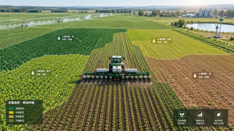
A field rarely behaves like a single production unit. One area may hold moisture longer after rainfall, another may have shallow topsoil, compacted headlands, uneven residue cover, or a different yield history that persists season after season. Yet many crop programs still apply seed, nutrients, water, and crop protection products at one uniform rate across the entire field. That approach is simple to administer, but it can hide costly differences.
Site-specific crop management is the practical process of identifying meaningful field variability and converting it into input zones that can be managed differently. For technical evaluation teams, the main question is not whether a field has variation. Nearly every field does. The more useful question is whether the variation is stable, measurable, operationally manageable, and economically relevant enough to justify a different application decision.
This distinction matters. A colorful satellite image may show sharp differences in crop vigor, but vigor alone does not tell a manager whether to apply more nitrogen, reduce seeding density, change irrigation timing, or leave the rate unchanged. Good site-specific crop management turns observations into defensible management actions rather than simply producing more maps.
Start with the production decision, not the technology
Precision agriculture projects often begin with a tool: a yield monitor, electrical conductivity survey, drone service, soil sensor, or variable-rate controller. That can be useful, but it is usually the wrong starting point for evaluation. The first step should be to identify the decision that needs improvement. Is the operation trying to avoid over-seeding weak ground? Correct recurring nutrient limitations? Reduce irrigation losses in light soils? Improve the consistency of a crop entering a processing contract?
The intended decision determines the data requirement. Variable-rate lime or phosphorus programs need a different evidence base than variable-rate nitrogen. Irrigation zones require an understanding of water-holding capacity, infiltration, pump capacity, emitter uniformity, and drainage behavior. Seed zoning depends on crop type, planting window, population response, residue conditions, and the yield potential that can actually be achieved in each part of the field.
A common mistake is to create zones from one season of imagery and assume they represent permanent productivity classes. In a dry year, apparent low-vigor zones may reflect shallow soil or poor water storage. In a wet year, the same locations may be affected by waterlogging, delayed planting, or disease pressure. A zone is more credible when its pattern appears across multiple seasons and can be explained by field conditions, not merely by one image date.
What makes an input zone usable?
An input zone should be more than a statistically distinct patch on a map. It must be large enough for the equipment to apply reliably, stable enough to remain useful over time, and linked to a response that the grower can influence. A narrow band that changes from year to year may be agronomically interesting but impractical for a planter, spreader, sprayer, or irrigation system to manage.
In practice, robust zones are often formed by layering several sources of evidence: cleaned yield maps from more than one harvest, soil sampling, elevation and terrain data, soil electrical conductivity or texture information, historical imagery, scouting notes, and where available, machine data such as planting records and as-applied logs. Each data source has limitations. Together, they can reveal whether a recurring low-yield area is related to drainage, compaction, salinity risk, nutrient availability, or a factor that cannot be corrected economically.
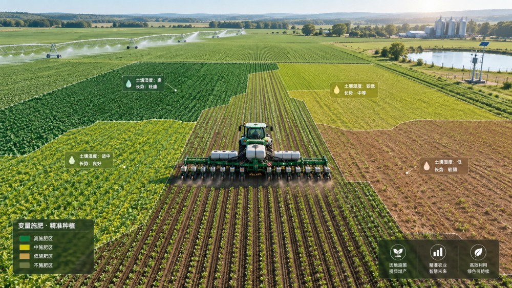
The important word is “layering.” Yield maps can be distorted by header width errors, delayed GPS correction, grain-flow lag, calibration problems, or harvest interruptions. Soil samples can be misleading when sampling points ignore natural field boundaries. Remote sensing can show symptoms without identifying causes. Technical teams should treat each layer as evidence to test, not as a final answer.
From field variability to seed, nutrient, water, and protection decisions
The value of zoning changes with the input being managed. For seed, higher populations are not automatically appropriate in every high-yield zone. A productive area may support more plants if water, fertility, and harvestability are reliable. But a zone with a history of drought stress, restricted rooting depth, or variable emergence may need a more conservative population. Equipment capability also matters: a prescription that changes too frequently may not be delivered accurately at planting speed.
Nutrient management is often where site-specific crop management has the clearest operational logic. Grid or zone sampling can distinguish broad areas with different pH or soil test levels, allowing corrective inputs to be concentrated where they are needed. Mobile nutrients require more care. A high-yield zone may have greater removal potential, but nitrogen decisions also depend on weather, mineralization, crop stage, previous crop, organic amendments, irrigation practices, and local nutrient-loss risk. A yield map should inform the question; it should not be treated as a nitrogen prescription by itself.
Irrigated systems present a different opportunity. Where irrigation infrastructure supports independent control, management zones can be based on soil texture, rooting depth, slope, drainage, and crop development. In center-pivot operations, variable-rate irrigation can be useful only when nozzle packages, control systems, water supply, and field geometry can deliver the intended pattern. In drip systems, zoning may be constrained by hydraulic design, block layout, filtration capacity, and fertilizer injection practices. A sophisticated map cannot overcome a system that has poor distribution uniformity or insufficient pressure control.
For crop protection, field zones are valuable for scouting priorities and risk assessment, especially where disease pressure, weed escapes, or pest habitat repeatedly follow moisture, drainage, or field-edge patterns. However, prescription spraying must remain aligned with product labels, local regulations, resistance-management principles, and the biology of the target. Some issues are too mobile or too fast-moving for a static zone approach. In those cases, timely scouting and threshold-based decisions may be more reliable than a preloaded map.
A disciplined workflow prevents “map-rich, decision-poor” projects
A workable implementation sequence usually begins with field history. Review crop rotations, drainage changes, land leveling, manure applications, irrigation events, known compaction areas, and changes in operators or equipment. These details are often absent from digital records, yet they explain a surprising amount of variation.
Next, standardize and inspect the available data. Yield data should be cleaned before it is compared. Soil sample locations need to be checked against proposed management boundaries. Imagery should be viewed alongside weather conditions and field observations. Then build a small number of operational zones, not the maximum number that software can generate. For many commercial operations, two to five zones may be easier to execute and evaluate than a highly fragmented prescription.
The prescription should be trialed with an evaluation plan. Keep a record of intended rates, actual rates, machine settings, weather conditions, and any deviations during application. At harvest, compare outcomes carefully. A simple comparison of average yield by zone may not be enough, particularly if zone boundaries were created from historical yield. The team should ask whether the changed input produced a response consistent with the underlying agronomic hypothesis and whether the response was sufficient to cover the added complexity.
This is also where procurement and technical assessment intersect. Before selecting sensors, mapping platforms, controllers, or service providers, confirm file compatibility, data ownership terms, GNSS accuracy requirements, machine connectivity, operator training needs, and support availability during critical application windows. A platform that exports a clean prescription but cannot communicate reliably with the existing terminal has limited practical value.
Where projects commonly lose value
The first failure point is poor data quality. Yield monitors that are not calibrated, incomplete as-applied records, and inconsistent field boundaries can create confident-looking but unreliable decisions. The second is causality: teams sometimes identify a low-performing zone and immediately increase inputs, even when the true constraint is drainage, compaction, shallow soil, or poor irrigation distribution. More input may simply increase loss or raise disease risk.
Another issue is operational burden. A variable-rate plan should fit the labor model. If prescriptions require frequent manual intervention, extra loading events, difficult product segregation, or complex troubleshooting during a narrow planting window, the theoretical agronomic gain may disappear. The best plan is often not the most granular one; it is the one the operation can execute consistently.
It is equally important to separate correctable zones from non-responsive zones. Some areas are chronically limited by conditions that cannot be economically changed. Their management may involve reducing input intensity, changing crop choice, improving drainage where feasible, introducing cover crops, or treating them as conservation or buffer areas. Site-specific management is not always about applying more precisely. Sometimes it is about recognizing where not to spend.
Connecting field decisions with the broader agri-food system
Field zoning is usually discussed as a farm-level practice, but its implications extend further. More consistent crop quality can affect storage planning, processing yields, ingredient specifications, traceability records, and supply reliability. For growers supplying processors, mills, feed manufacturers, or controlled-environment operations, the relevant measure may not be yield alone. Uniform maturity, moisture management, residue compliance, protein targets, or disease-related quality risk may be equally important.
This wider perspective is why technical teams benefit from structured intelligence that connects production systems with machinery, irrigation, biological inputs, food safety, processing, and logistics. AFBN’s agri-food and bioscience coverage is useful in this context because a field-level decision is rarely isolated. Fertigation design can affect nutrient strategy; biological crop inputs may require different handling and timing; harvest quality can shape downstream storage and processing requirements.
A mature site-specific crop management program does not begin with the promise of uniform savings across every hectare. It begins with a field question that matters, builds evidence from several sources, and tests a practical response with equipment that can deliver it. When zones are based on stable, explainable variation and are reviewed after each season, they become less like digital artwork and more like an operating tool for allocating inputs where they have a credible job to do.